দোয়াব
দোয়াব ( হিন্দি: दोआब, উর্দু: دوآب,[১]) (শব্দের উৎস: ফারসি: دوآب দোআব, দো অর্থাৎ দুই + আব অর্থাৎ, জল বা নদী থেকে) হল ভারত ও পাকিস্তানে ব্যবহৃত একটি শব্দ, যার অর্থ 'জিহ্বা'[২] বা দুটি নদীর সংযোগস্থল বা প্রবাহের মধ্যবর্তী অঞ্চল।[৩] অক্সফোর্ড হিন্দি-ইংলিশ ডিকশনারি-তে আর. এস. ম্যাকগ্রেগর দোয়াব শব্দটির সংজ্ঞা দিয়েছেন: "a region lying between and reaching to the confluence of two rivers (esp. that between the Ganges and Jumna)." ("দুটি নদীর মধ্যবর্তী স্থান এবং সংযোগস্থলের মধ্যবর্তী অঞ্চল (বিশেষত গঙ্গা নদী ও যমুনা নদীর মধ্যবর্তী"))[১][৪]
| দোয়াব दोआब دوآب | |
|---|---|
| প্রাকৃতিক অঞ্চল | |
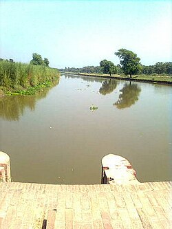
 পাঞ্জাব দোয়াবের নিম্ন বারি দোয়াবে একটি খালের দৃশ্য | |
| দেশ | ভারত ও পাকিস্তান |
উত্তর ভারত ও পাকিস্তানে অনেক নদী প্রবাহিত হয়েছে, যেগুলির উৎস হিমালয়। সেই কারণে এই অঞ্চলের সমভূমি একাধিক দোয়াবে বিভক্ত। সিন্ধু-গাঙ্গেয় সমভূমি ক্রমান্বয়ে একাধিক খাদর ও বাঙ্গর অঞ্চলে বিভক্ত। বন্যাপ্রবণ নিম্নভূমি অঞ্চলটিকে বলা হয় বাঙ্গর এবং নদী থেকে উচ্চতর অংশে অবস্থিত অংশটির নাম খাদর।[৫]
ঐতিহাসিকভাবে, দোয়াবের গ্রামগুলি সরকারিভাবে 'খাদর', 'খাদর-বাঙ্গর' (অর্থাৎ, মিশ্র) ও 'বাঙ্গর' - এই তিন শ্রেণিতে বিভক্ত ছিল। বহু শতাব্দী এই শ্রেণিবিভাগের ভিত্তিতেই স্তরভিত্তিক জমি-উৎপাদনশীলতার মান অনুসারে এখানে বিভিন্ন প্রকার কৃষিকর আরোপিত হয়েছে।[৬][৭]
পাদটীকা
সম্পাদনা- ↑ ক খ McGregor 1993, পৃ. 513।
- ↑ doab or duab, n., OED Online, Oxford University Press, সেপ্টেম্বর ২০১৩, সংগ্রহের তারিখ ১১ সেপ্টেম্বর ২০১৩
- ↑ Doab., Webster's Third New International Dictionary, Unabridged., ২০১৩, সংগ্রহের তারিখ ১১ সেপ্টেম্বর ২০১৩
- ↑ মুহম্মদ এনামুল হক, সম্পাদক (জুন ২০১১)। "স"। বাংলা একাডেমি ব্যবহারিক বাংলা অভিধান। ঢাকা: বাংলা একাডেমী। পৃষ্ঠা ১১২১। আইএসবিএন 984-07-4939-0।
সমস্থলী: গঙ্গা ও যমুনার মধ্যবর্তী ভূভাগ; দেয়াব।
- ↑ Pakistan: Soils, Encyclopædia Britannica, 2010,
... khaddar soils. Away from the river, toward the middle of the doabs, older alluvial soils (called bangar) are widely distributed ...
- ↑ F.C. Channing, Land Revenue Settlement of the Gurgaon District, Government of India,
... The rates here applied were the same as those applied in the Bangar and Khadar circles and the same comparisons hold good ...
- ↑ Oswald Wood, R. Maconachie, Final report on the settlement of land revenue in the Delhi District, Government of India, 1882,
... The Khadar-Bangar chak lies along the river; 37 villages are purely Khadar and 39 partly Khadar partly Bangar. The villages nearest the river are subject to inundations, but where the water runs off in time, the natural fertility of the ...
তথ্যসূত্র
সম্পাদনা- McGregor, Ronald Stuart (১৯৯৩), The Oxford Hindi-English Dictionary, Oxford University Press, পৃষ্ঠা 513, আইএসবিএন 978-0-19-864339-5, সংগ্রহের তারিখ ১১ সেপ্টেম্বর ২০১৩