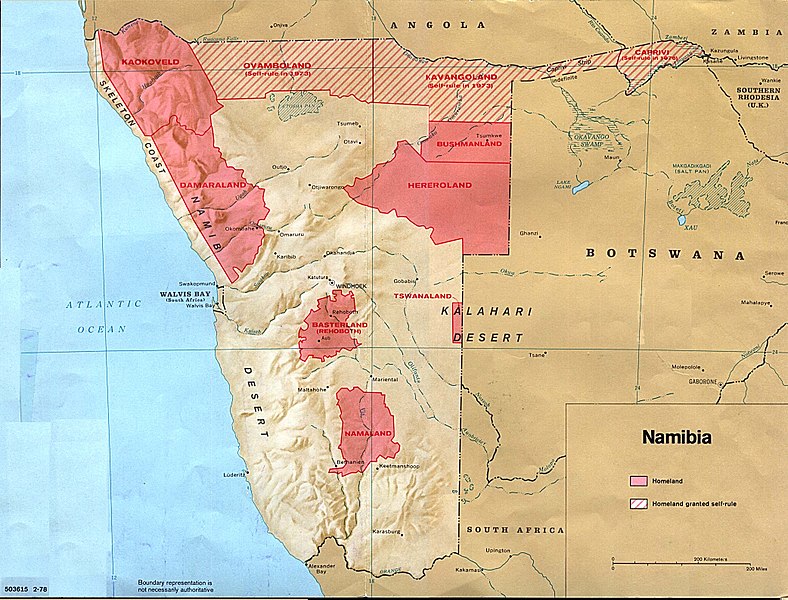
চিত্র:Namibia homelands 78.jpeg

এই প্রাকদর্শনের আকার: ৭৮৮ × ৬০০ পিক্সেল। অন্যান্য আকারসমূহ: ৩১৬ × ২৪০ পিক্সেল | ৬৩১ × ৪৮০ পিক্সেল | ১,০০৯ × ৭৬৮ পিক্সেল | ১,২৮০ × ৯৭৪ পিক্সেল | ২,০৮৪ × ১,৫৮৬ পিক্সেল।
পূর্ণ রেজোলিউশন (২,০৮৪ × ১,৫৮৬ পিক্সেল, ফাইলের আকার: ৫৫১ কিলোবাইট, এমআইএমই ধরন: image/jpeg)
ফাইলের ইতিহাস
যেকোনো তারিখ/সময়ে ক্লিক করে দেখুন ফাইলটি তখন কী অবস্থায় ছিল।
| তারিখ/সময় | সংক্ষেপচিত্র | মাত্রা | ব্যবহারকারী | মন্তব্য | |
|---|---|---|---|---|---|
| বর্তমান | ০৫:০৯, ১৭ এপ্রিল ২০০৬ |  | ২,০৮৪ × ১,৫৮৬ (৫৫১ কিলোবাইট) | Foundert~commonswiki | {{Information| |Description= |Source=[http://www.lib.utexas.edu/maps/africa/namibia_homelands_78.jpg] Produced by the US government, probably the CIA |Date= 16:17, 11 September 2005 . |Author=. AlbertR (Talk) |Permission=This work is in the public domai |
সংযোগসমূহ
নিচের পৃষ্ঠা(গুলো) থেকে এই ছবিতে সংযোগ আছে:
ফাইলের বৈশ্বিক ব্যবহার
নিচের অন্যান্য উইকিগুলো এই ফাইলটি ব্যবহার করে:
- af.wiki.x.io-এ ব্যবহার
- Namibië
- Bophuthatswana
- Bantoestan
- Ciskei
- Sjabloon:SA-Tuisland
- Transkei
- Gazankulu
- Suidwes-Afrika
- Qwaqwa
- Venda (tuisland)
- Lebowa
- KwaNdebele
- KaNgwane
- KwaZulu
- Boesmanland (bantoestan)
- Damaraland
- Oos-Caprivi
- Hereroland
- Kaokoland
- Kavangoland
- Namaland
- Ovamboland
- Rehoboth (bantoestan)
- Tswanaland
- Skedelkus
- Koevoet (polisie-eenheid)
- ar.wiki.x.io-এ ব্যবহার
- ast.wiki.x.io-এ ব্যবহার
- azb.wiki.x.io-এ ব্যবহার
- be.wiki.x.io-এ ব্যবহার
- bg.wiki.x.io-এ ব্যবহার
- ca.wiki.x.io-এ ব্যবহার
- Resolució 246 del Consell de Seguretat de les Nacions Unides
- Resolució 264 del Consell de Seguretat de les Nacions Unides
- Resolució 269 del Consell de Seguretat de les Nacions Unides
- Resolució 276 del Consell de Seguretat de les Nacions Unides
- Resolució 283 del Consell de Seguretat de les Nacions Unides
- Resolució 284 del Consell de Seguretat de les Nacions Unides
- Resolució 385 del Consell de Seguretat de les Nacions Unides
- Resolució 435 del Consell de Seguretat de les Nacions Unides
এই ফাইলের অন্যান্য বৈশ্বিক ব্যবহার দেখুন।
